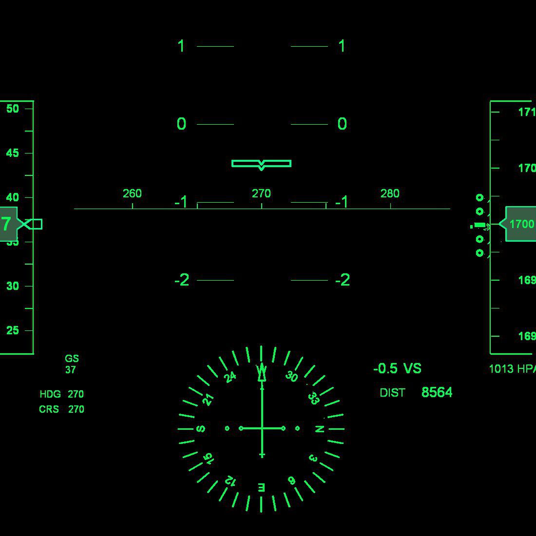
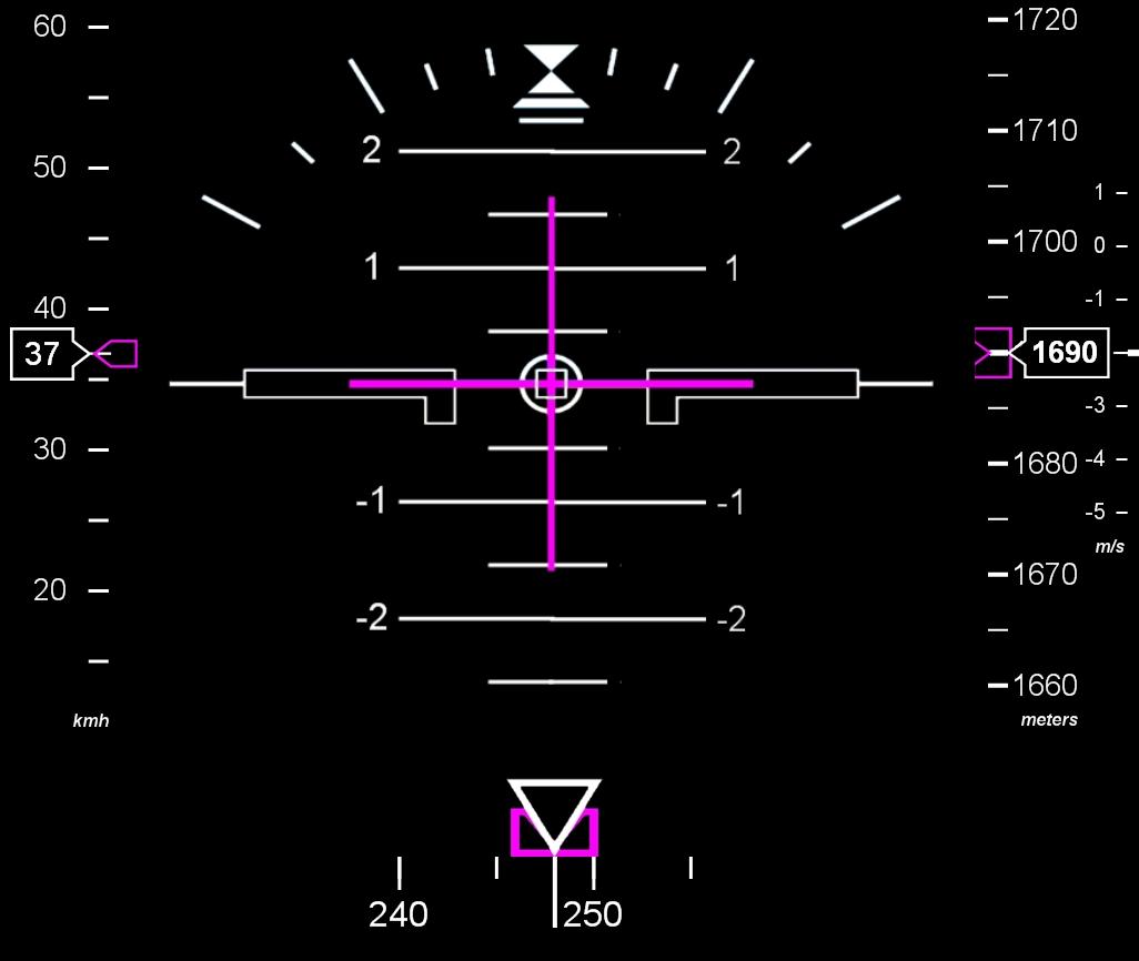
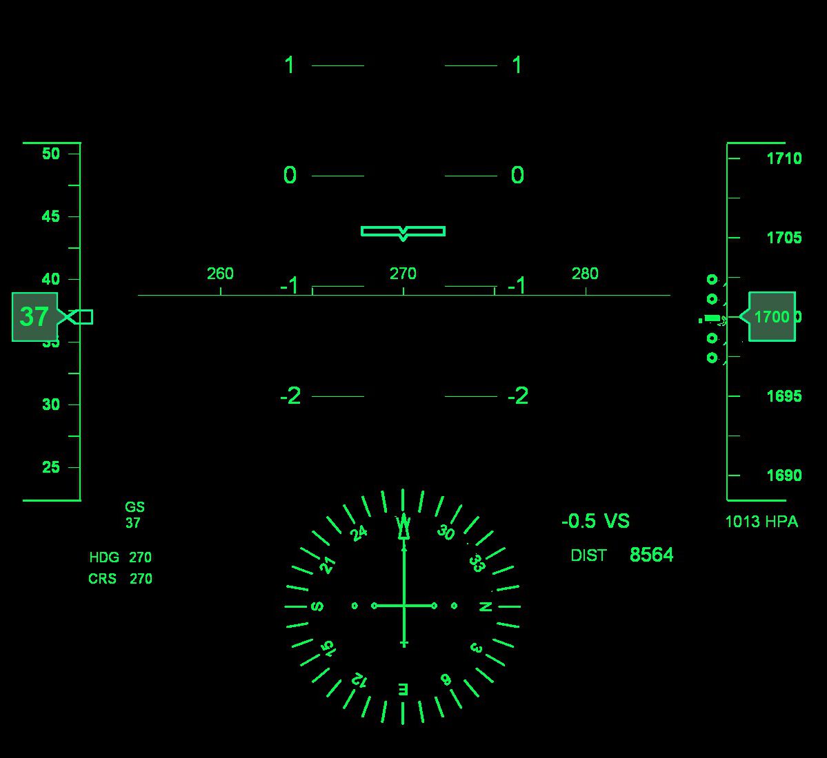
Overlaying your videos with flight data

Your flight computer registers your flight tracks, which contain quite a number of parameters but at least time, position (lat/lon) and altitude. The more advanced ones register even the number of G’s pulled. You might want to overlay your flight video’s with these flight data. Here you will find a couple of gauges which you can use as overlay to your video’s as well as the required Dashware software.

Dashware

To allow for the creation of the overlays you have to install Dashware. Dashware is free and easy to use software that allows you to add highly-customizable telemetry overlays to your flight videos. Dashware isn’t supported anymore by its creators, but the version you can download here still works fine under Windows 10. Instruction for use can be found here.

Click button to download Dashware


The gauges

The gauges, although some of them they might look like quite advanced (as the HUD), have simplified functionality due to the supported gauge design functionality. But feel free to experiment with it and change the gauges to your liking.

The gauges are scalable to any size you prefer and can be put on any place on the screen. The gauges can be downloaded for free, but I’d appreciate if you would refer to this site in your video or description.


B737 Primary Flight Display avionics

The gauges are not really minimalistic but you may like to enhance your video, or part of it, with the ‘B737 Primary Flight Display’ avionics derived style tapes.

You might also want to use the gauges for flight analysis purposes or in presentations.

See a demo in the video clip.

The Airspeed is in km/h, Vertical Speed in m/s. Heading, as you might have guessed, in degrees.

Airspeed Indicator
The Central Vertical Speed Indicator is a simplification of the Attitude Indicator, showing only the climb/sink rate.
Combined Altitude and Vertical Speed Indicator
Heading Indicator

Click buttons to download gauges


NextGen Head Up Display

The Head Up Display (HUD) overlay consists of just one gauge.

When applying the HUD gauge, align the horizontal heading indicator (the line with the numbers 260, 270 and 280) with the horizon. This will result in partly hiding the lower compass (approx one third).

See a demo in the video clip.

The functionality of this gauge is limited. Values presented are Airspeed (tape on the left and GS) , Altitude (tape on the right), lift/sink (4 circles left of the altitude tape, the attitude/VSI indicator at the centre and VS), Heading (compass and HDG/CRS) and distance from the start (DIST).

HUD display

Click button to download gauge


The Simple Avionics Strip

The Simple Avionics Strip overlay consists of just one gauge, showing Speed, Climb/Sink rate, Altitude and Distance flown.

See a demo in the video clip.

Paragliding light avionics strip

Click button to download gauge