
About the weather
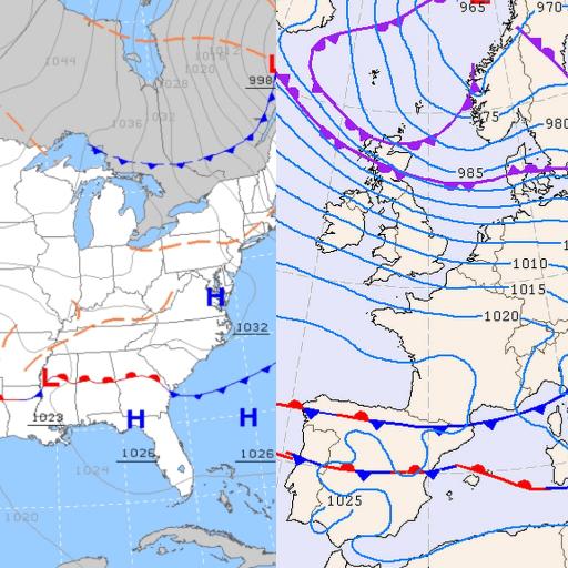
When planning a flying trip, knowing what the weather might do in the coming days is key. The Surface Pressure Forecast charts give you a five-day outlook of how large-scale weather systems could develop, helping you spot patterns that might affect your flying plans.
The main purpose of these charts is to help you decide whether it’s a good idea to travel to a flying destination or not. They offer a big-picture view of the atmosphere, showing possible changes in pressure systems, fronts, and overall weather trends that could shape conditions in your chosen area.
Keep in mind, though, that these charts focus on large-scale weather. For local and more detailed forecasts, it’s best to check dedicated sources such as Burnair Map, spotAIR FFVL, Meteo Parapente, Paraglidable, or Windy — these tools will help you understand what’s happening right where you plan to fly.

Europe Android App
DWD, UKMO (color and B/W) and KNMI models for Europe.
US & Alaska Android App
NOAA’s Weather Prediction Center (WPC) model for the US and Alaska
Europe, US and Alaska on-line
No Android phone? Check the Europe, US and Alaska model outputs here!