paragliding HUB
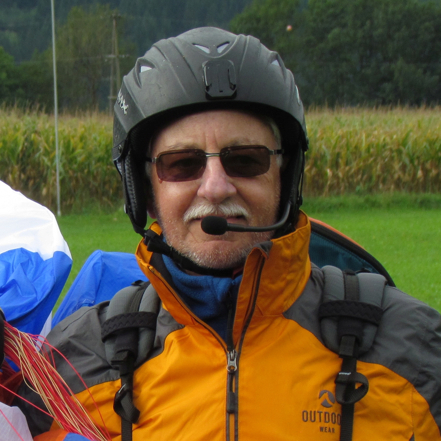
From surface pressure charts and Apps, paragliding pilot retrieve App, radio channel and CTCSS tone selection to personal paragliding video clips.
flight data video overlays
Telemetry overlays to your flight videos using Dashware, which is free and easy to use software. The overlays are derived from various avionics displays.
flight simulation airport tool
Netherlands Airport info. Only to be used for VFR flight simulation. The info contains METAR, (ILS) Runways, VFR Approach Charts and Aerodrome Charts.
my thematic and
random songs
Songs for Global Change, on sustainability, responsibility and change and Random Songs, an unpredictable blend of songs born from spontaneous ideas.
A few highlights
Boosting your real‑world and MSFS VFR flying with practical tools for weather insight, detailed Netherlands airport information and paragliding flight data video overlays.
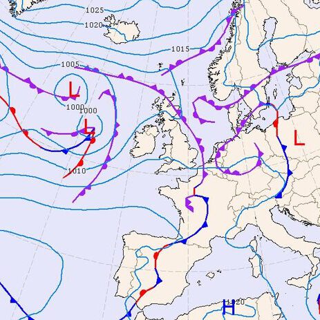
Surface Pressure Charts Europe Android App
The Surface Pressure charts will present you the most recent analysis and 5-day forecast on the possible development of large scale meteo conditions. For the Europe charts three different models are available. The models are the ICON model of DWD , the MSLP data of UKMO and the ECMWF data of KNMI.
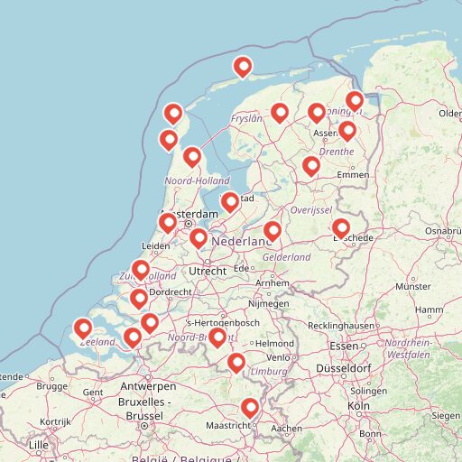
MSFS VFR flights simulation airports tool
Netherlands Airport info. Only to be used for VFR flight simulation. The info contains METAR, (ILS) Runways, VFR Approach Charts and Aerodrome Charts for 22 airports. It includes Aeronautical Information Publication (AIP) info and Aeronautical charts by LVNL, Air Traffic Control The Netherlands.
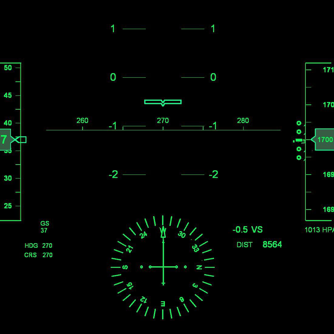
Flight Data Video Overlays
Your flight computer registers your flight tracks, which contain a lot of parameters but at least time, position (lat/lon) and altitude. You might want to overlay your flight video’s with these flight data. Here you will find a couple of gauges which you can use as overlay to your video’s as well as the required Dashware software.
contact ME